Devil’s Prongs
Date Hiked: 11 June 2024
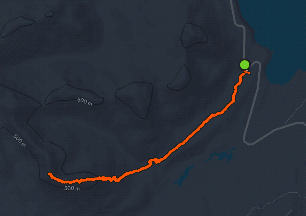
Distance: 6.50 miles
Elevation: 2,771ft
Difficulty: Extra Hard
Features: Dramatic ridgeline walk, steep incline with no trail, small river crossing, mountain goats
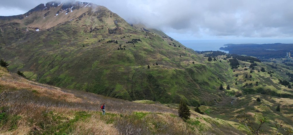
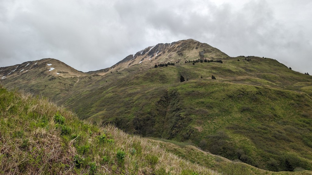
Description: This has been on my bucket list to complete since the day I landed in Kodiak, and it was the last hike I did before I became too injured to do anymore intense activities. Devil’s Prongs ridgeline can be seen from directly behind the Alaska Airlines building when you step off the airplane in Kodiak… ever since first stepped off and saw those tall, unforgiving, jagged peaks, I made it a mission to figure out how to get up there.
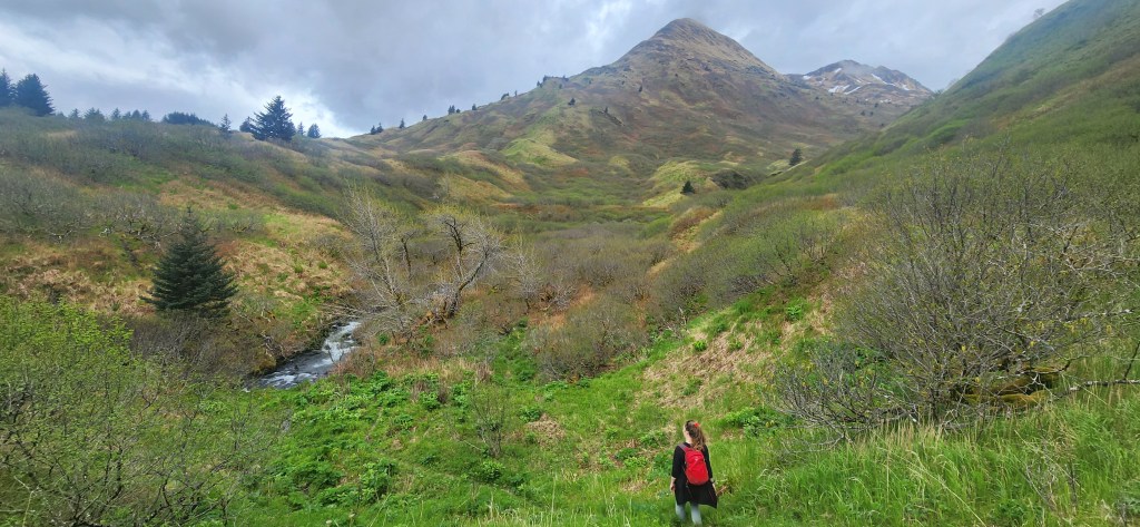
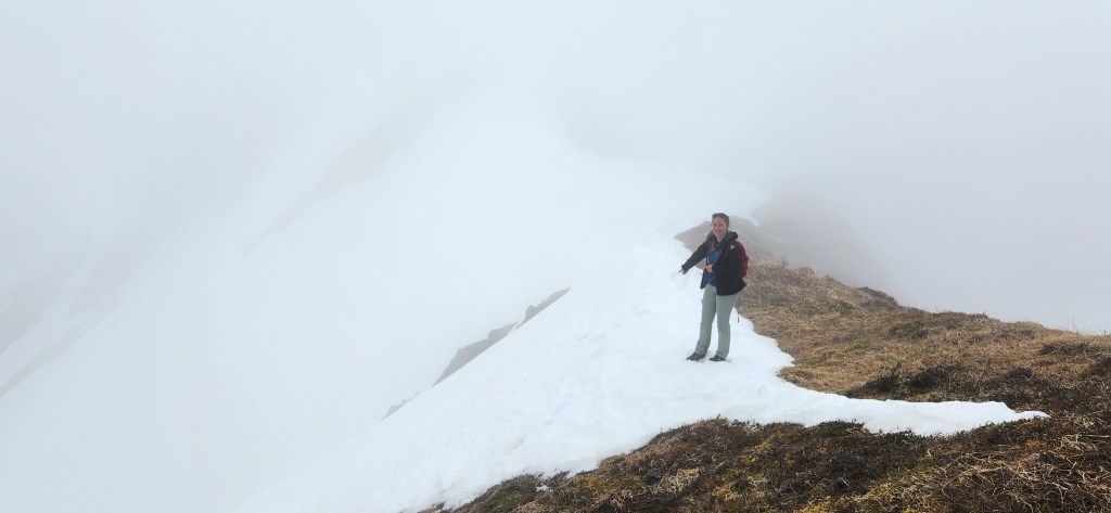
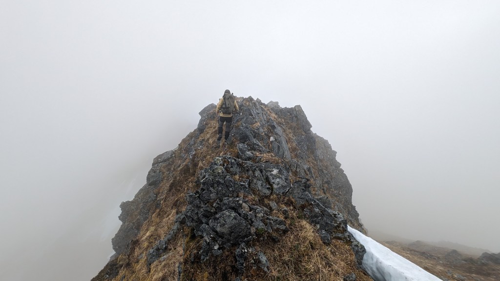
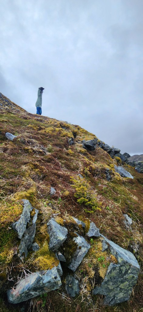
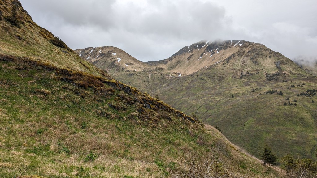
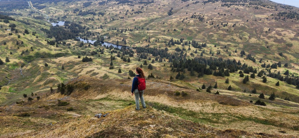
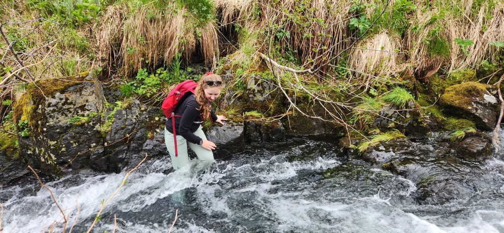
We started hiking on the Bench Trail. This trailhead is before the base of North Sister Mt., on the left side of the road marked by two blank metal posts. The Bench Trail has a small initial incline, followed by a steady flat trail alongside the Southeast side of the Three Sisters, revealing scenic views of the mountains. The trail was pretty muddy, but we could jump between wood planks to stay out of it. At the end of the Bench Trail, we found a way to climb down to the river between us and the Devil’s Prongs Ridgeline. There we found a narrow section of far enough from rapids and crossed. It was about knee deep, a strong quick current, and 8 feet wide. From there we started the climb. There was no trail from this point on, so we forged our own path up the mountain.
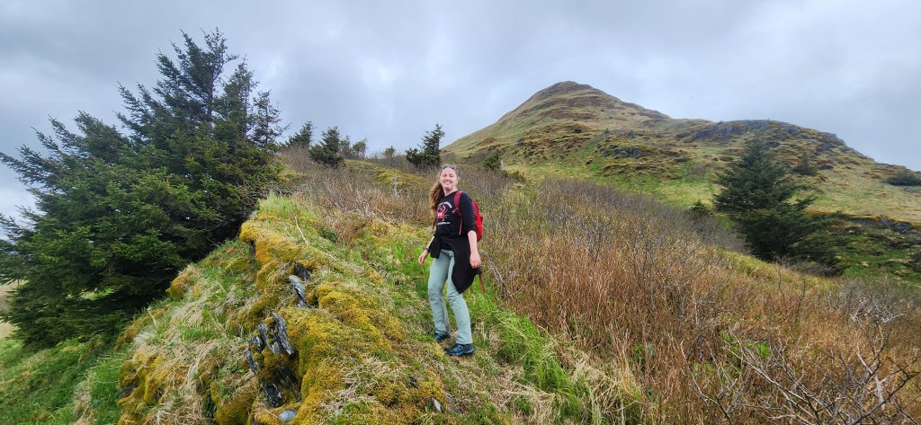
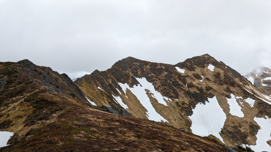
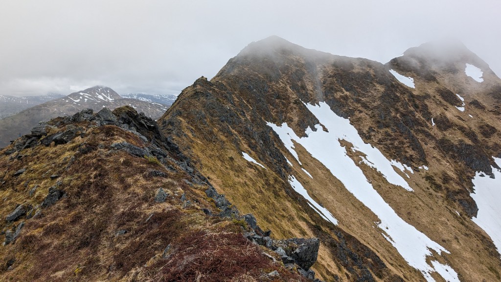
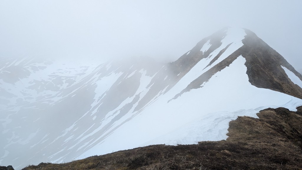
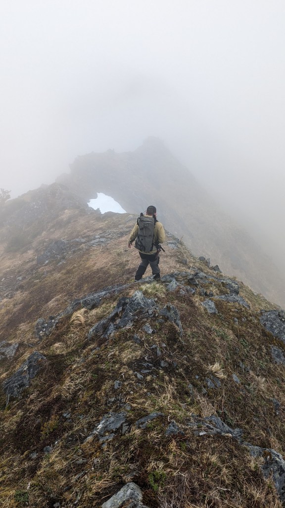
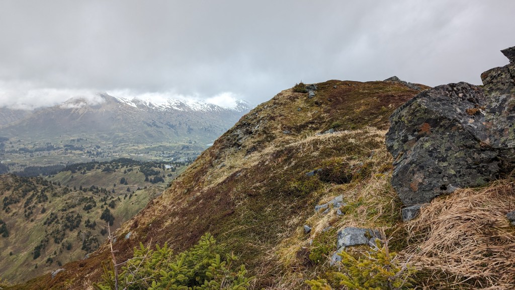
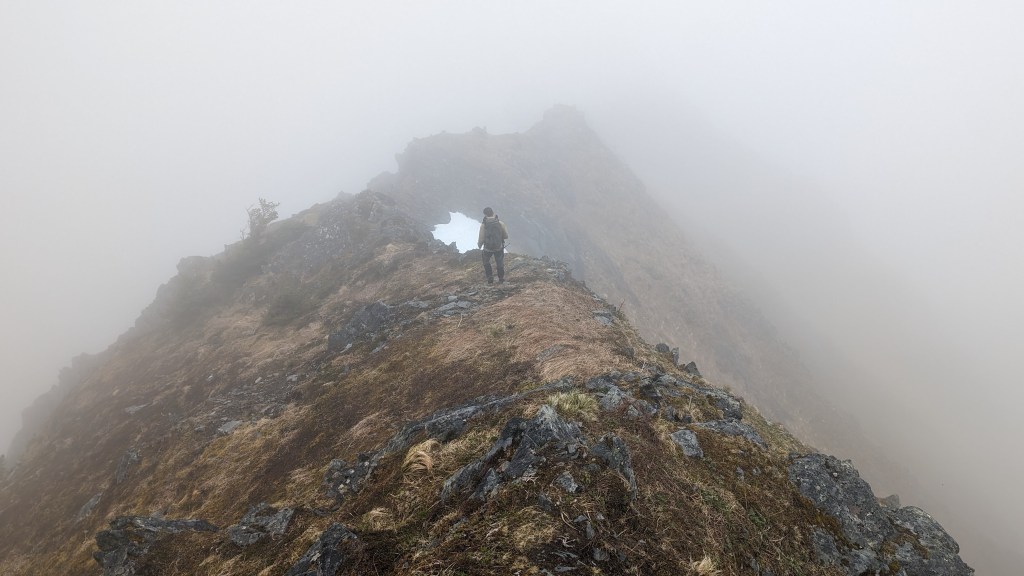
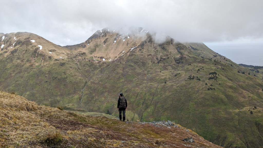
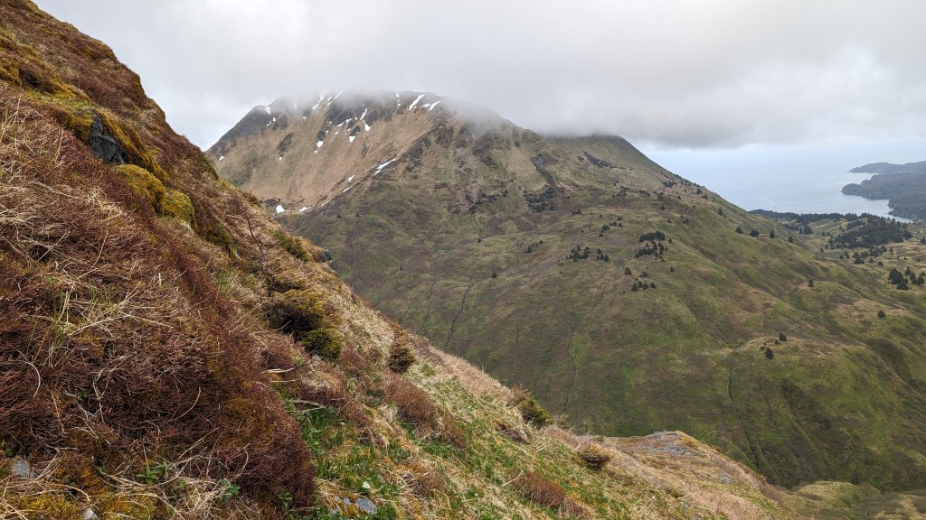
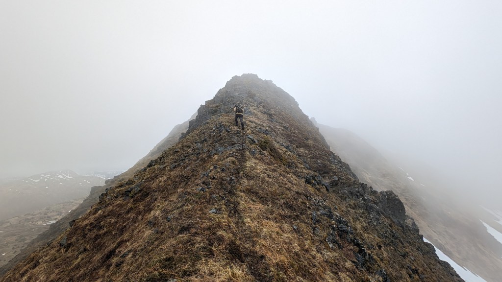
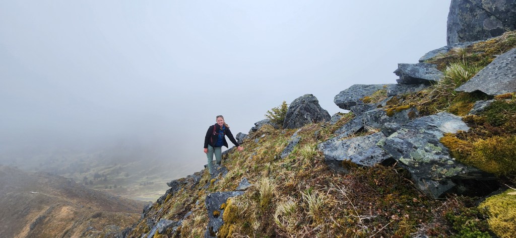
The slope was very steep, often we had to use a hand to pull on the ground growth as we climbed up. The photo above shows our ascent. To the right there were fantastic views of the inland Devil’s Prongs ridge that aren’t visible from anywhere else on the island. As we increased elevation, we rose into the clouds. They seemed to form and collect in the bowl north of us with South Sister Mt. at the Northeast end, then travel south, blanketing the peaks of the ridge we stood on. When we reached the top of the initial peak, the ridgeline opened up. Ridges are my favorite thing, it was jagged, zig zagging, and steep on either side… we climbed over narrow rocky scrambles, walked on top of the world, and gazed at snowy peaks on the rounded steep ridge. It was a dream! Up there was a no-fall-zone, but wide enough to feel comfortable. While we didn’t get 360 views at the top, but the clouds did make it feel like our own world and, to my surprise, created the sense that we were lost at the top of an other-worldly place. We stopped when we reached Moonbowl, a place on the south face with snow still skiable in June. Would have loved to continue on but turned around due to time constraints. It was amazing, would highly recommend, but only for those who are looking for a more intense adventure, experienced at hiking, and not afraid of heights. This was AMAZING and I would love to do the whole ridge when I’m healed up!