Shelly Lake
Date Hiked: 28 June 2025
Distance: 9.2 miles
Elevation: 2,924 ft
Difficulty: Moderate – Hard
Features: Rivers, waterfall, open meadow, dramatic landscapes, colorful lake, cliffs, forest, one river crossing
Description: Shelly lake is arguably one of the most beautiful places on Kodiak Island. I have hiked this trail twice: most recently for a friend’s birthday and previously in October 2023. Pictures from the October hike can be seen on the Sharatin Mt. page where my friend and I hiked up the face of Sharatin Mt. via the Red Cloud trail, summitted, and descended the backside of Sharatin on the Shelly Lake Trail. This page shows the second trip to Shelly, via the Shelly Lake trail. Cont.

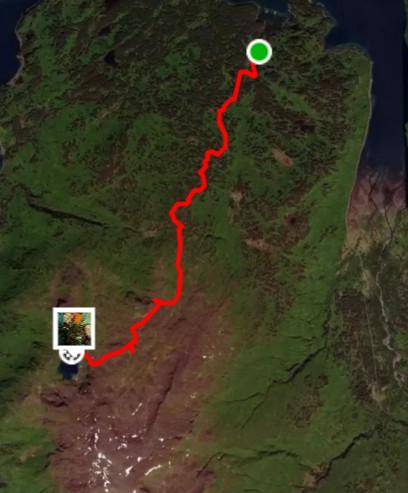
This is a moderately hard out-and-back trail. The first stretch includes a few short steep inclines followed by a gradual incline for the remainder of the hike. The Shelly Lake trailhead is at the very end of Anton Larson Road, on the northern base of Sharatin Mt. There are sections throughout the hike that are somewhat muddy or hard to follow, but finding the trail again is manageable.
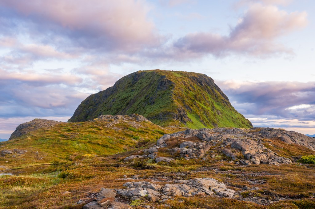
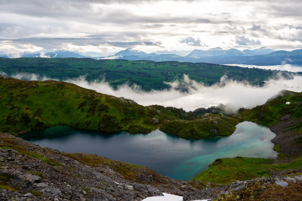
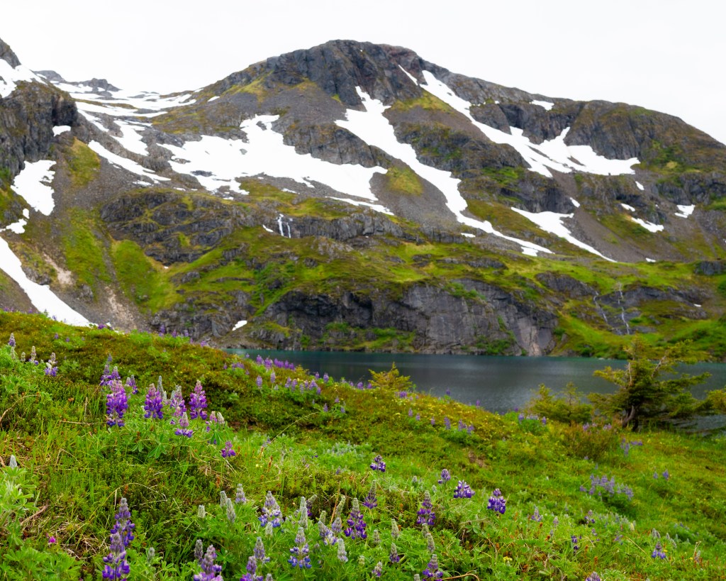
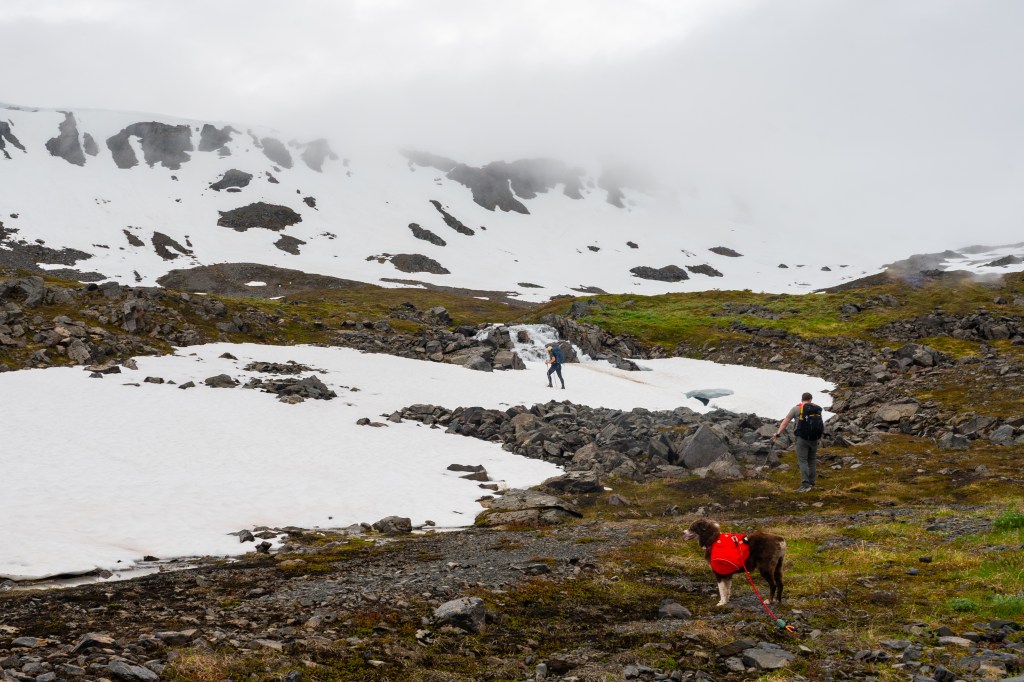
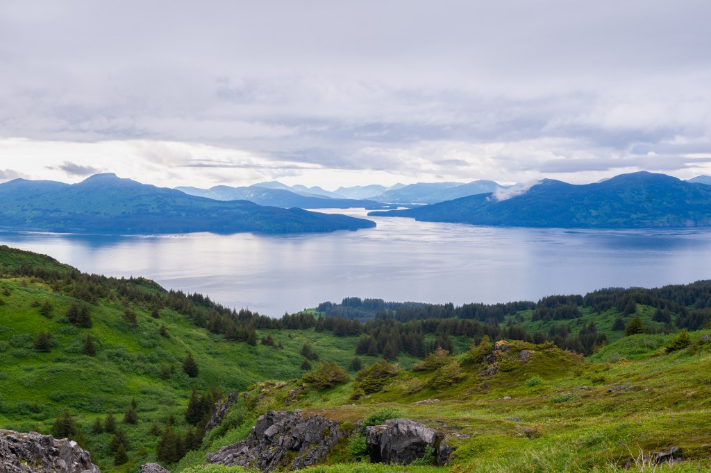
The first 2/3 of the trail takes you through a heavily forested area, where you meander past streams and through dense, mossy, forest. As you approach the tree line, views begin to open up and you get to wander through gorgeous alpine meadows, around rugged mountain landscapes, and beautiful wildflowers or ground growth depending on the season. Little offshoots can take you to overlooks with epic views of the vast and true wilderness of the Kodiak Archipelago.
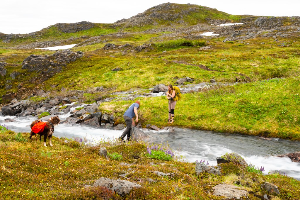
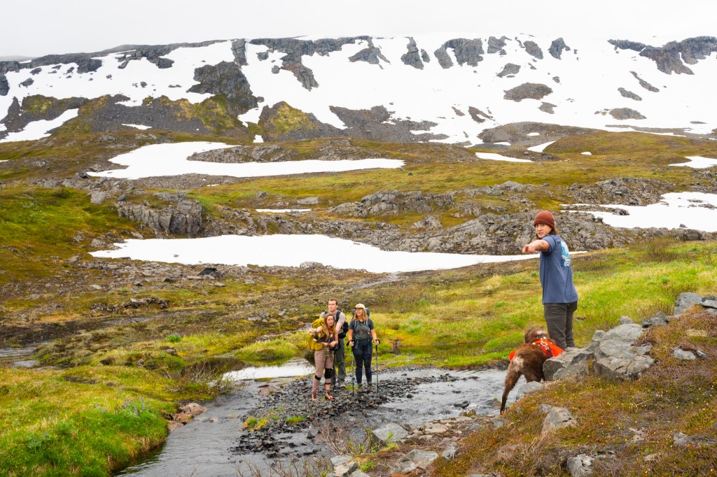
The trail becomes hard to follow from time to time as elevation increases, but the meadows are so open it is easy to find again if you head in the correct general direction. There is a moderate river crossing about 3.5-4 miles in. Some sections can be deep and very fast moving, but farther up are potentially safer shallow and wide areas. Use your best judgement. Your feet will likely get a little wet. Cont.
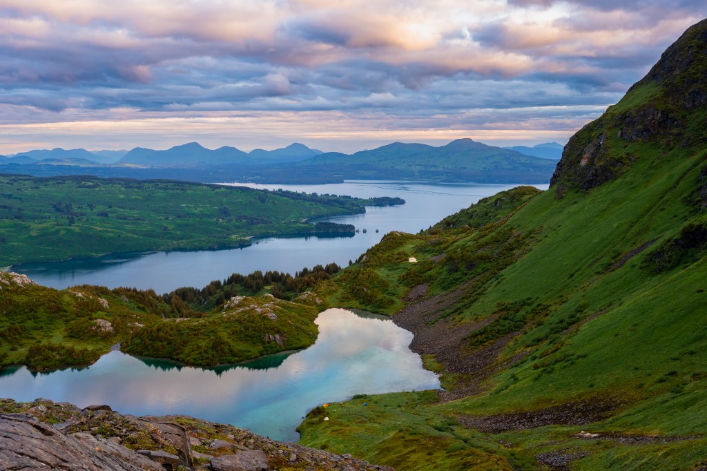
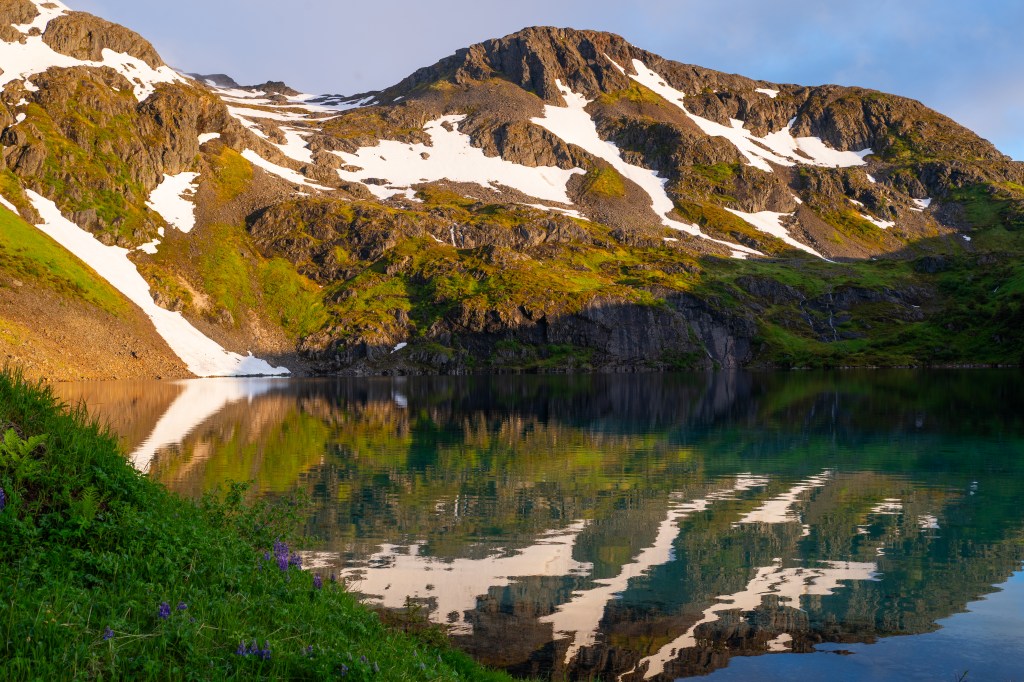
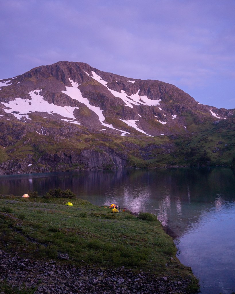
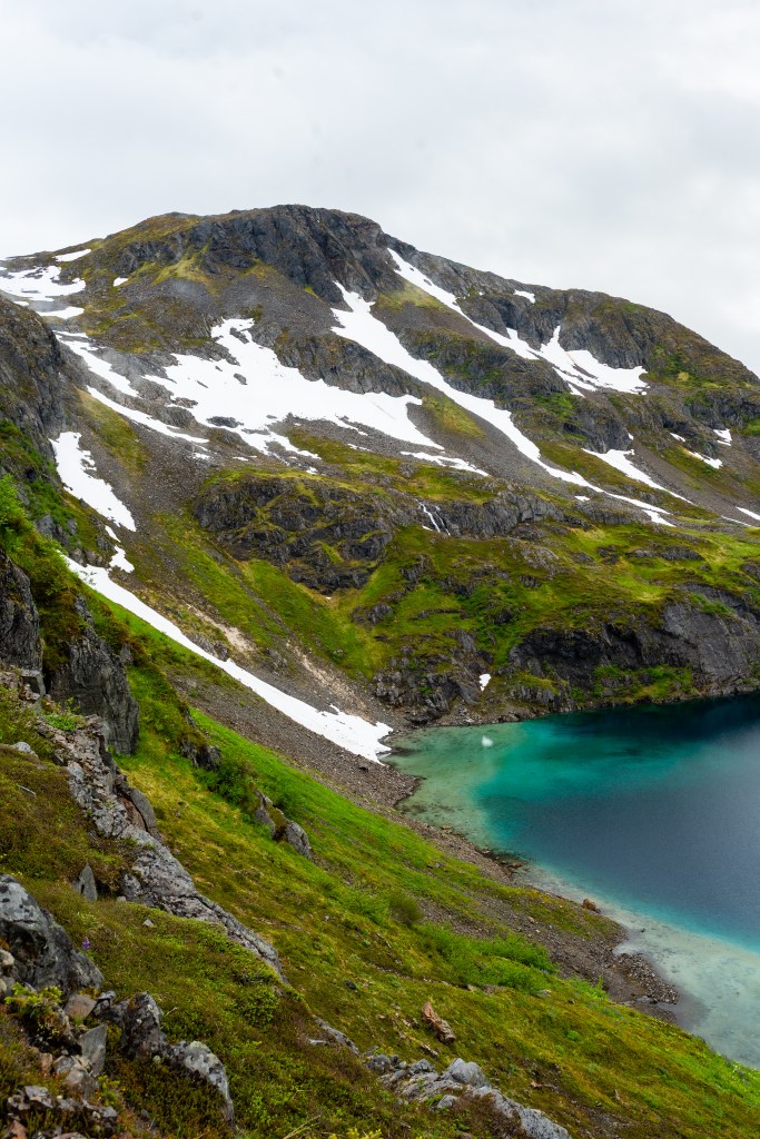
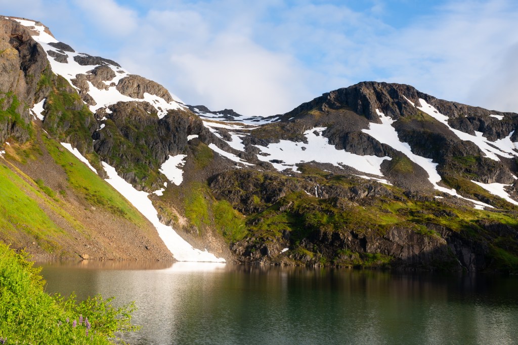
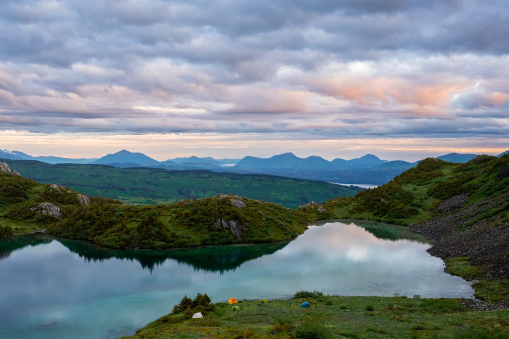
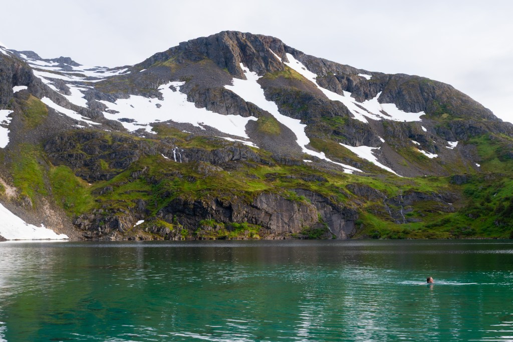
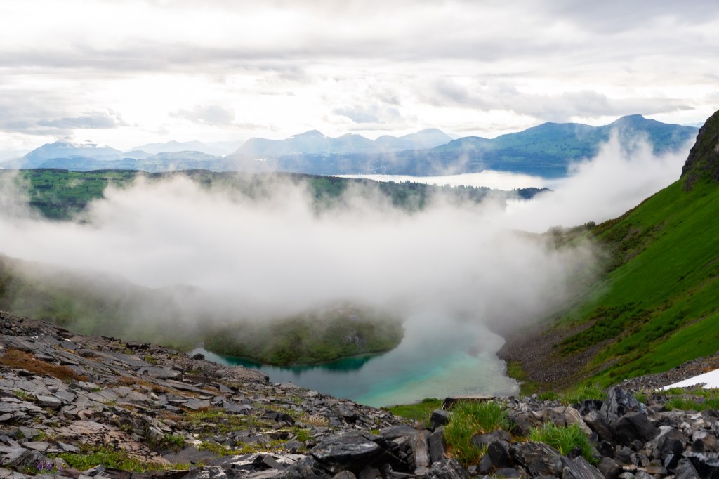
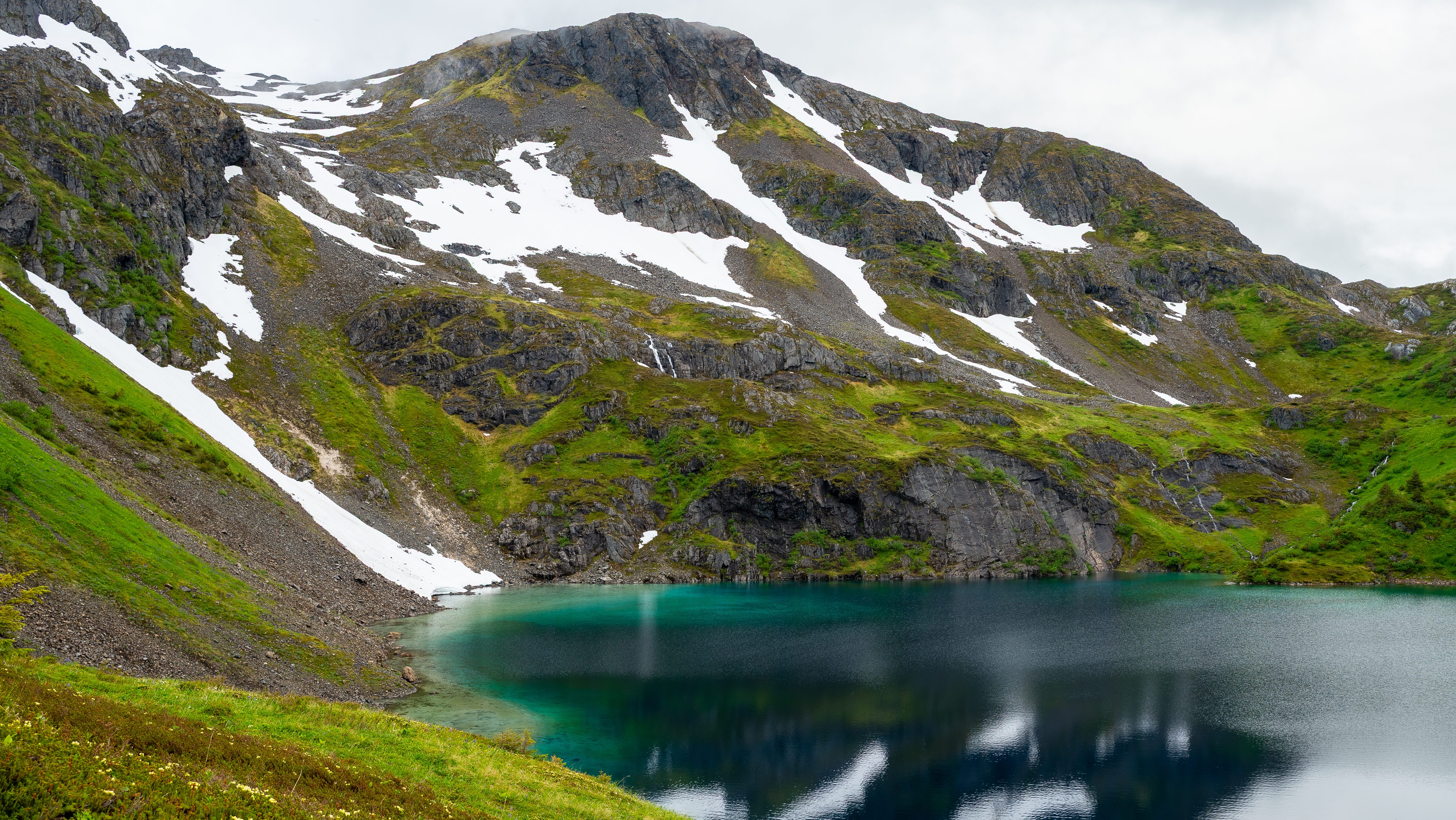
After a final short steep section of incline, the trail levels off again as you approach the highest point of the hike. At this point Shelly Lake comes into view, multicolored, glittering, and nestled between steep snowy cliffs with views of Port Lions, the surrounding mountainous islands, and ocean.
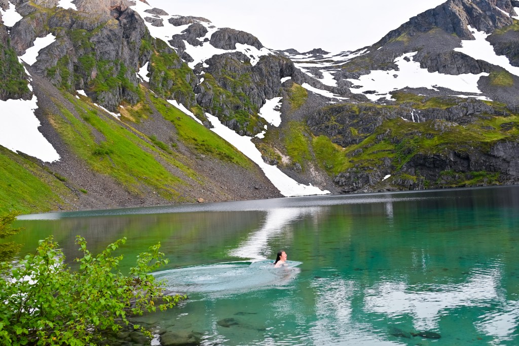
From there you can either enjoy the view and turn back or pick your way down to the lake. The descent is steep, but after you can walk up to the water’s edge and enjoy a magical time by this stunning alpine lake. Watch out for loose rocks and mud on your way down the trail to Shelly Lake. Cont.
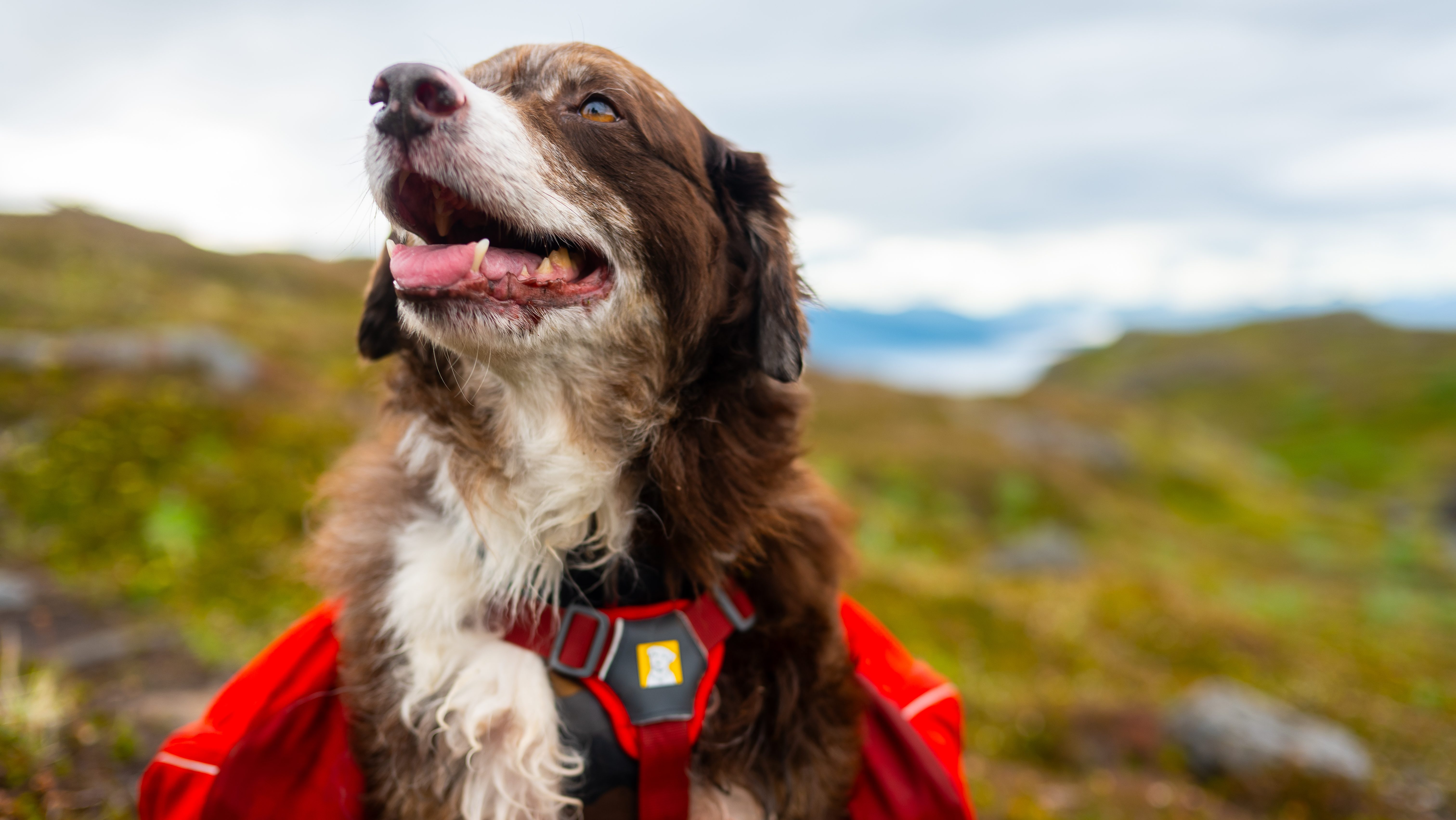
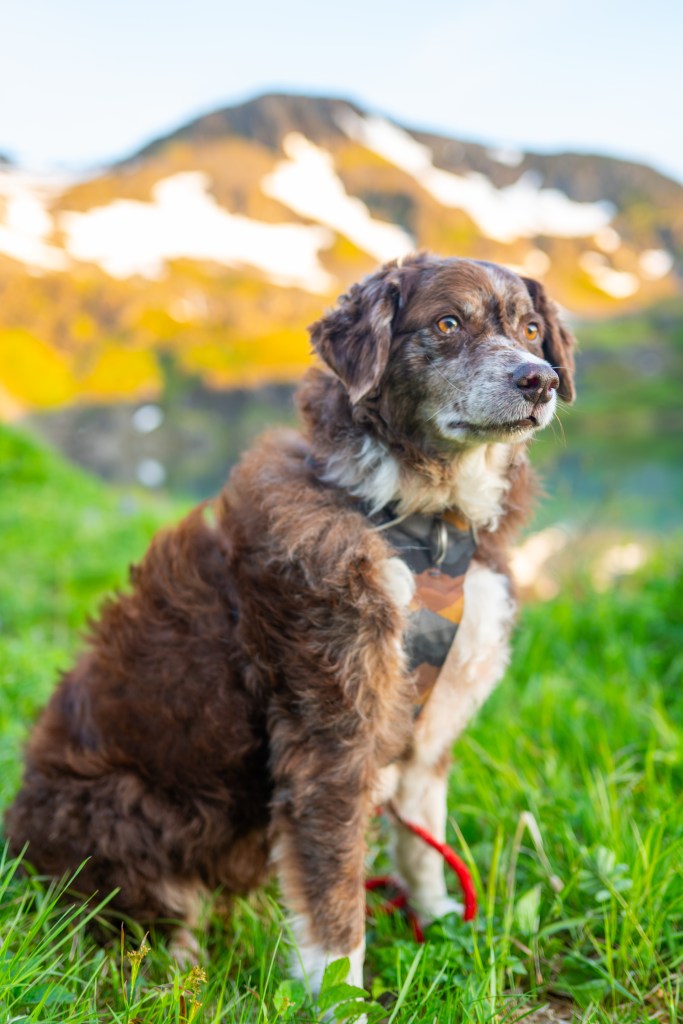
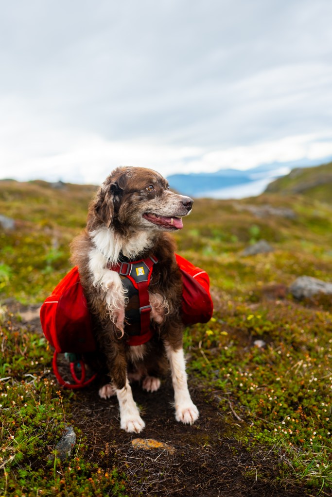
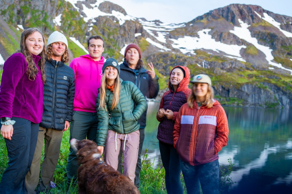
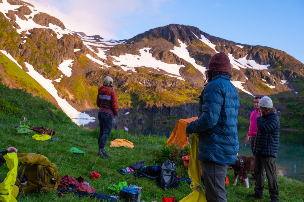
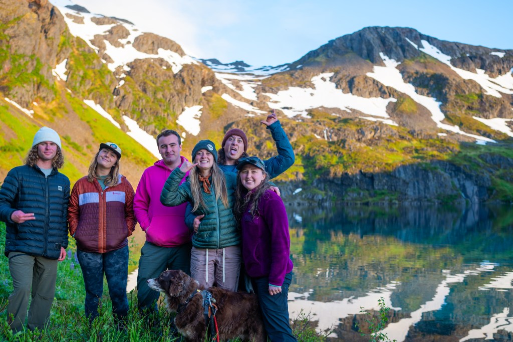
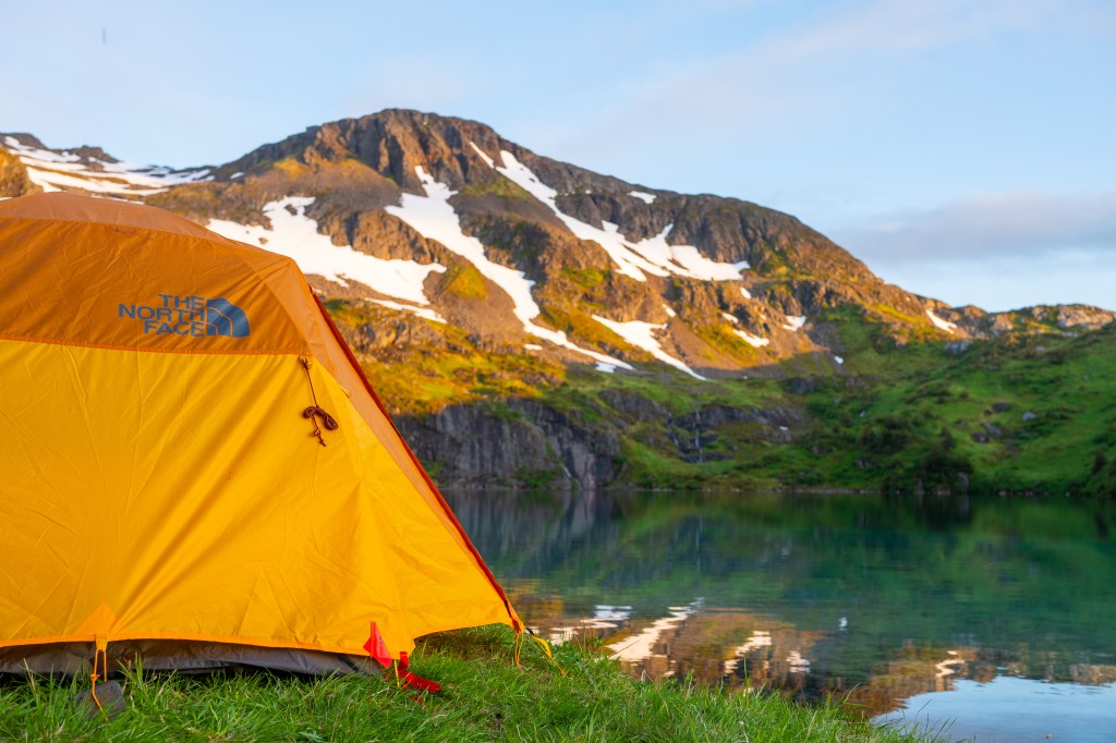
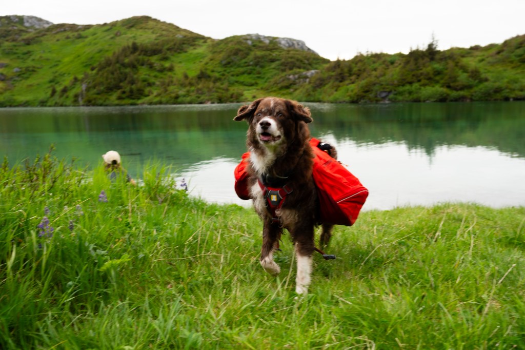
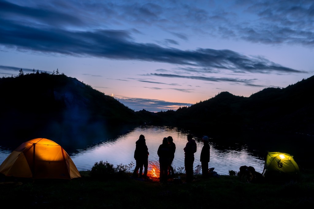
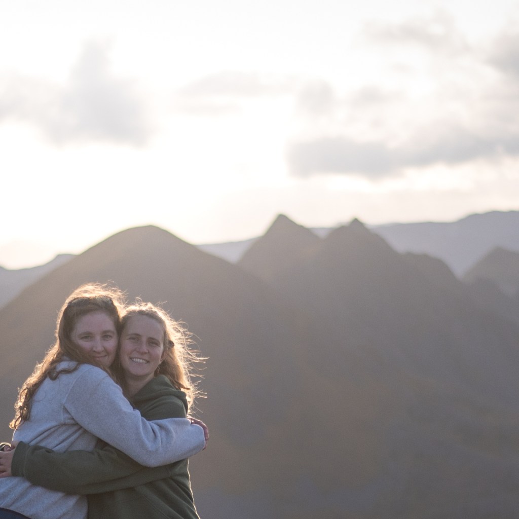
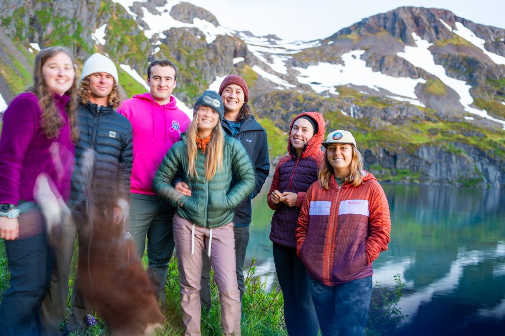
The photos on this page here are from a backpacking trip we took to celebrate a friend’s birthday with a Shelly Lake Pool Party. We took the Shelly Lake trail both ways. Although I am still injured, I was able to complete the trip with great help from my lovely friends carrying supplies and Chance the puppy clipped to my backpack’s waist strap dragging me up the trail! The lake water was frigid but extremely refreshing. I personally love cold water and ended up swimming all over to the deepest sections of the lake.
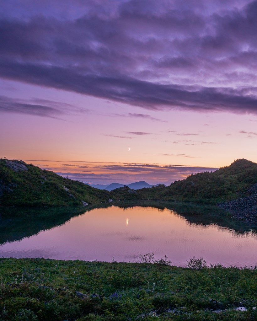
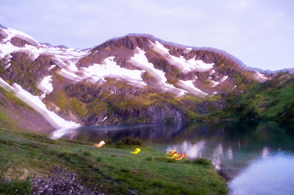
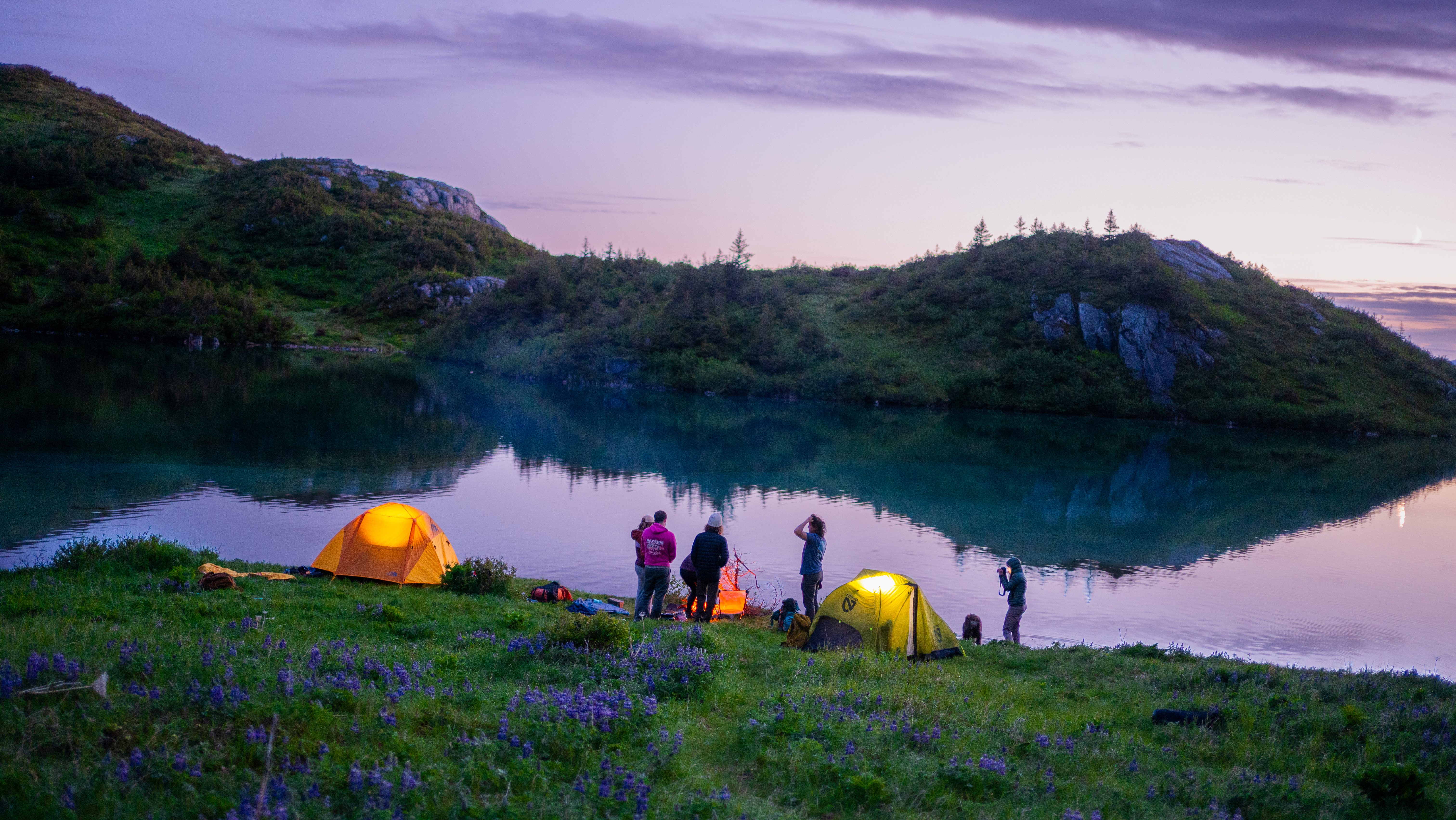
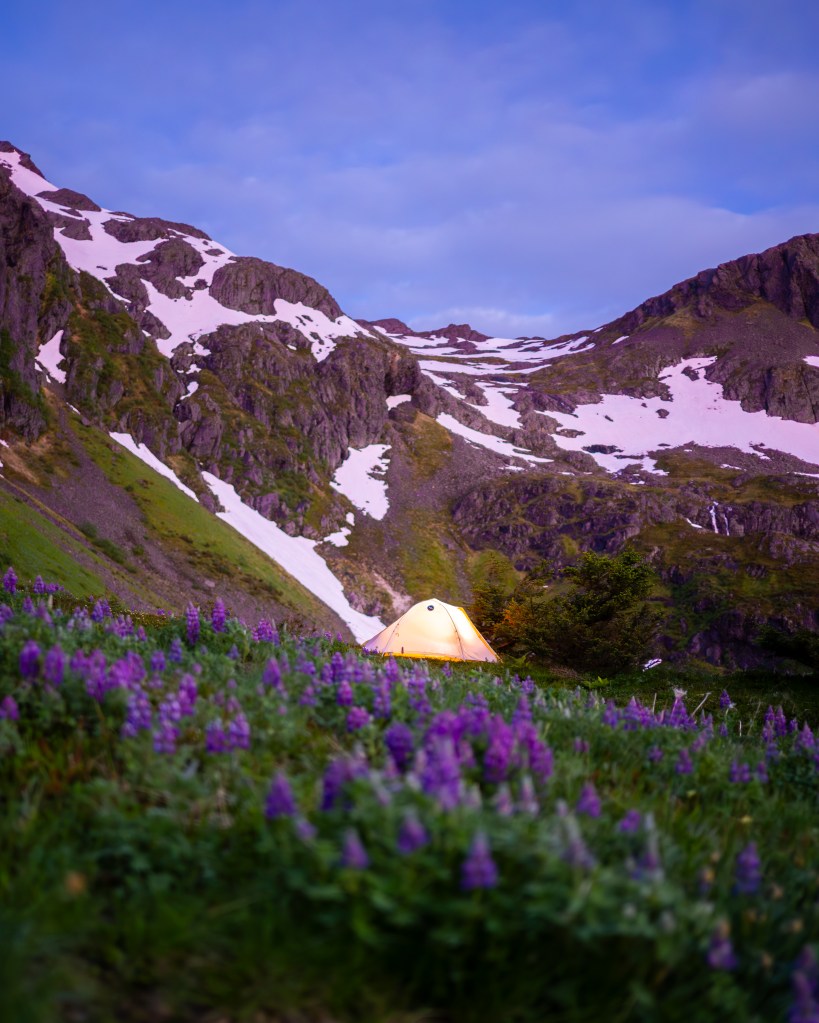
We set up tents by the lakeside, built a small campfire out of fallen wood and pack out trash, and spent a night under bright skies. Golden hour lasted from around 10:30pm until midnight and the sky never truly got dark. I packed out solo early the next morning, around 5:45, about 40 minutes after sunrise. The remnants of a dazzling sunrise painted color in the sky, lighting up the clouds and casting a glow across the land. Overall, an unreal amazing time, would highly recommend.
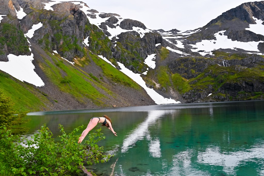
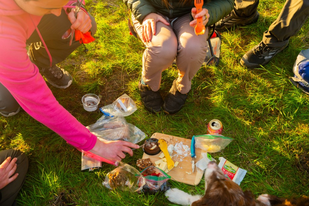
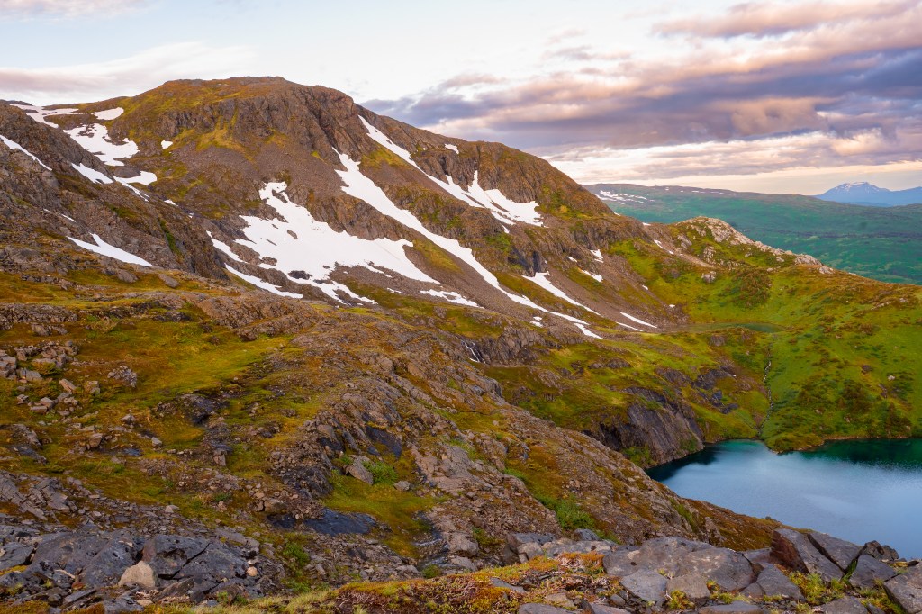
Photo Gallery: